• About UGM
  • Engineering Faculty
  • English
    • Bahasa Indonesia
    • English
Universitas Gadjah Mada Universitas Gadjah Mada
Faculty of Engineering
Unconventional Geo-resources Research Group
  • Home
  • About Us
    • Welcome
    •  Rector’s Welcome
    •  Our Milestones
    • Researchers
    • Management
    • Partners
    • Contact Us
  • Articles
  • News & Events
  • Research
    • Our Research
    • Research Topics
    • CCUS
  • Publication
    • Patent
    • Journal
    • Conference Proceedings
  • Perspectives
  • EASTEM-UGM
    • UGM
    • EASTEM
    • SGLC-ERIC
      • ABOUT SGLC-ERIC
      • Activities
  • Home
  • Post by
Post by :

Aulia Agus Patria

Freshgraduate student of Geological Engineering Department, Universitas Gadjah Mada.

3 UGM Students Secured 1st Place in Poster Competition “Young Scientists’ Symposium Visions for The Future of Geoscience”

News & Events Friday, 1 April 2022

In the midst of concerns about the Covid-19 pandemic. Students are required to stay active. three students from Gadjah Mada University who spent their time studying online and working on their thesis decided to take part in the competition. They are Fadli Robi A, Bunga Fitri S, Iknanda Januar Rizaldi from the Department of Geological Engineering, Faculty of Engineering who participated in the Call for Posters competition “Young Scientists’ Symposium Visions for The Future of Geoscience” Future of Digital Technologies in Geoscience held by RWTH Aachen University and Gadjah Mada University in March 2022.

The competition is part of the international conference agenda which presents speakers from 3 universities, namely RWTH Aachen University, University of Queensland, and Gadjah Mada University. The agenda for the activities of this competition was held on March 18, 2022. The poster competition was selected directly by the international committee.

This competition is divided into 2 stages, the first stage is submission and the second stage is the presentation stage. In practice, this competition is held online through the Gather Town platform. The use of this platform is the first for the three UGM students. This platform allows all participants or spectators to move between poster stands with avatars that can be run freely. In this competition, Fadli, Bunga, and Iknanda won 1st place by beating their competitors from various of local and foreign universities

Geological mapping of Muara Enim and surrounding areas

News & Events Sunday, 10 May 2020

This geological mapping activity is one of the efforts to support the increase of coal production and the development plan of new PLTU in South Sumatra.

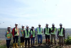
Photos of UGRG Team performing geological mapping in Muara Enim and surrounding areas (PHOTO: FERIAN ANGGARA/UGM)

The UGRG team resumed its observation and sampling activities in the field. The fieldwork this time was a geological mapping conducted in the Tanjung Enim area, South Sumatra. This mapping activity is a form of cooperation between the UGRG Team and one of the coal mining companies to encourage increased in coal production and support the development of a new Steam Power Plant (PLTU) in the South Sumatra region

The new PLTU is targeted at generating electricity with a capacity of 2 x 620 MW. In addition, the company has also operated the PLTU 266 MW Banjarsari and is a supply about 1.5 million tons coal fuel per year. Because a lot of coal production need to be fulfilled by the company, it is necessary to further research on the potential of coal to drive increased in coal production.

The mapping team were consist of six people which performed a mapping for approximately two weeks. Activities undertaken in the geological mapping include rock identification, rock-lining measurements, stratigraphy measurements, and sampling. Furthermore, laboratory and studio work was also taken to make geological maps, research area stratigraphy, and calculation of coal reserves.

The field condition faced by the team during mapping was the natural forest environment of Sumatra which requires mapping teams to explore the forests and rivers to get the necessary geological data. From the results of the mapping it was known that the area still has the potential of coal reserves to boost coal production and support development plans of new PLTU in South Sumatra.

Figure 1. Photograph of one of the coal outcrops in central Banko Area (Photos by: F. Anggara)

From Waste to Smart Technology

News & Events Saturday, 2 May 2020

The fieldwork this time was carried out in coal mines and several PLTU locations around Tanjung Enim. This activity aims to review the potential of Rare Earth Element and Yttrium in coal and fly ash-bottom ash (FABA).

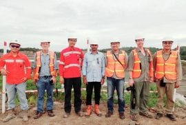
Photograph of the team conducting research in Tanjung Enim area (Photo: F. Anggara/UGM)

The field activities this time were quite different from the field activities that had been carried out before, from the number of team members who were more than usual, the field destinations visited were also more, and the time of the visit also coincided with the month of Ramadan, but this actually made the activities in the field to be more interesting and challenging. This research aims to explore the potential of Rare Earth Element and Yttrium (REY) in coal and ash from coal combustion, commonly known as fly ash and bottom ash (FABA).

Coal sampling was carried out in several fields belonging to one of the coal companies, while the FABA samples were taken at several PLTU around the Muara Enim. This research activity involves researchers from the geological engineering and chemical engineering of Universitas Gadjah Mada.

The three appointed teams then carried out the field activities according to their respective duties. As usual, the activities begin with safety induction by the company. The hot weather in the coal mines does not discourage the team spirit.

After completing the field activities at UPTE, we also had the opportunity to visit Palembang before returning to Yogyakarta. After arriving in Yogyakarta, we immediately conducted sample preparation for further analysis. The output of this research activity is to discuss the potential of REY on coal and its extraction from FABA, as well as other derivative products of cenosphere and geopolymer. Some research related to this activity and the results can be seen in the publication menu of UGRG team.

Figure 1. Photo of ash stack (FABA) from coal burning in PLTU

Trip Notes on Exploring the Ombilin Basin

News & Events Friday, 1 May 2020

The journey starts from the search for the oldest coal mine in Indonesia, the Ombilin coal mine, to visit the basement of Sumatra Island.

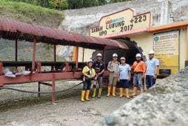
Photo: Dr. Ferian Anggara and team’s at the entrance of Sawah Luwung mine which is one of the observation and sampling locations (PHOTO: F. ANGGARA/UGM)

This research trip visited West Sumatra. Some of the locations that are targeted for this research trip are visited to further uncover the geological potential in the West Sumatra. The three-day trip was still not enough to explore targeted locations in West Sumatra, starting from the basement to the latest deposit.

Coal Potential in Ombilin

The first trip was to visit one of the oldest mines in Indonesia which is also a world heritage site; the Ombilin coal mine, located in Sawahlunto City, West Sumatra. On the first trip we had the opportunity to visit PT. Bukit Asam Ombilin Mining Unit to take samples for research. The journey begins with safety induction. Dark conditions, narrow alleys, wet, and occasional lorries passing by make us have to be more careful. The mine is still in production, but since it has been established as a World Heritage site, several functions switch for educational and tourism purposes.

Figure 1. One of the coal outcrop in Ombilin area, West Sumatra (Photo by: F. Anggara)

The geothermal manifestations in Sawahlunto

Not far from Ombilin’s coal mine, precisely in the area of Padang Ganting, there are several geothermal manifestation in the form of hot water found in some locations. The hot spring is used as a tourism destination, but it is still unknown whether the manifestation actually holds a significant potential of geothermal energy in West Sumatra. The water pH observation and measurement was also performed by Dr. Nukman, one of the researchers that focused on geothermal energy. The manifestation is quite unique because the location is quite far from the existing volcano and raises curiosity towards the formation of such manifestations.

Recent Volcanic Deposits

On the way to the inn, we stopped in Tanah Datar regency to visit quarry outcrop. Due to the high curiosity, we approached and observed the quarry. Surprisingly, the quarry is a product of volcanism that is interpreted as a product of Malintang and Singgalang volcanism. Not only doing observations, sampling in the form of pumice, charcoal and bulk samples are also performed mainly by Dr. Esti who was very interested in the outcrop. The sample is planned to be further investigated for deposit characterization to reveal its origin and potential in the future.

Harau Valley Geotourism

Moving westward, precisely in the Lima Puluh Kota Regency, we also visited one of the famous tourist sites in West Sumatra; the Harau Valley. Harau Valley presents a rural atmosphere surrounded by steep cliffs with breccia and conglomerates lithologies . Not only presents a beautiful view, in the Harau Valley there are also several waterfalls that further complement the tourist destinations in this area.

The Granitoid Basement of Sumatra Island

At the end of this trip, we took the time to visit the city of Solok to take some granite samples for further research on the potential of granite on the island of Sumatra. This outcrop is one of the ideal outcrops and we also found several types of granitoid stones that have been broken through basalt intrusion, making the second trip this time closed with a sense of satisfaction and fun.

Figure 2. Dr. Nukman and Dr. Ferian on granitoids rocks that are the constituent of Sumatra Island’s Basement (photo by: F. Anggara)

Senakin Peninsula Excursion

News & Events Wednesday, 22 April 2020

The fieldwork carried out by the UGRG Team in collaboration with several researchers from Australia aims to evaluate the origin of sediments and the depositional environment of the Tanjung Formation.

Photo of UGRG Team with several researchers on the Senakin field excursion. From left; Arutmin Team, Mike Friederich, Elino Febriadi, Arutmin Team, Donatus Hendra Amijaya, Tim Moore, Ferian Anggara (PHOTO: FERIAN ANGGARA / UGM)

At the beginning of December 2017, Dr. Ferian Anggara and Dr. D. Hendra Amijaya conducted research in collaboration with several researchers from Australia including Dr. Tim A. Moore of Queensland University of Technology and Mike C. Friederich of Independent Consultant, Kenmore, Australia. This research aims to determine the origin and depositional process of the Eocene’s Cape formation. This field activities also cooperate with PT. Arutmin Indonesia which assists the needs of permits, safety equipment, and logistics during field activities.

In general, the activities went smoothly and well, the researchers managed to get some of the samples that were targeted such as basalt rock and volcanogenic rocks that compose the upper part of the main seam coal with a fresh state. Some samples were then carried out for further analysis such as mineralogy, geochemistry, palinology and the potential of rare earth element (REE). Laboratory investigations were conducted at the Universitas Gadjah Mada and Queensland University of Technology.

This research resulted in several publications including Extended Abstract at 35th Annual Convention of The Society for Organic Petrology in Beijing, China in 2018. On April 1, 2020, one of the publications of this research has been published in the Indonesian Journal on Geoscience Vol. 7, No. 1 April 2020: 65-85 under the title “Syn-sedimentary Mafic Volcanics in the Eocene Coal-bearing Tanjung Formation, Senakin Peninsula, South Kalimantan (Borneo), Indonesia”. 

Figure 1.  One of the activities is recording geological data, stratigraphy measurement, and sampling (photo by: F. Anggara)

Other studies have also continued to date, including research on geochemistry of igneous rocks and coal, the potential of rare earth element and yttrium in Senakin coal, and regional geology of the Tanjung Formation and Pasir Sub-basin.

Figure 2. Tim Moore is recording geological data on the basalt, which composes the Senakin area (photos by: F. Anggara)

Source:

Moore, Tim A., Mike C. Friederich, Jessica Trofimovs, Ferian Anggara, D. Hendra Amijaya, 2020, “Syn-sedimentary Mafic Volcanics in the Eocene Coal-bearing Tanjung Formation, Senakin Peninsula, South Kalimantan (Borneo), Indonesia”, Indonesian Journal on Geoscience Vol. 7, 2020

Tim Moore. “Tanjung Formation, SE Kalimantan: Geochemical and Sedimentological Evaluation, Cipher Coal Consultant, 2018”, https://www.researchgate.net/project/Tanjung-Formation-SE-Kalimantan-geochemical-and-sedimentological-evaluation

Tim Moore. “Field Work in the Senakin Peninsula: Part I – Tanjung Dewa Revisited, Cipher Coal Consultan, 2018”, https://www.ciphercoal.com/field-work-in-the-senakin-peninsula-part-i-tanjung-dewa-revisited/

Unconventional Geo-resources Research Group team conducts peat research in Muara Siran

News & Events Wednesday, 22 April 2020

Aware of the importance of peatland benefits as well as potential catastrophes that can be caused by peat damage, Dr. Ferian Anggara and his team conducting research and conservation efforts on peatland in Muara Siran, East Kalimantan.

Photo between the UGRG team led by Dr. Ferian Anggara and local residents in Muara Siran, East Kalimantan (PHOTO: FERIAN ANGGARA/UGM)

Peat is a wetland that is accumulated by the remnants of plants in a closed water body, so that decay activity by bacteria becomes obstructed. The accumulated plant remnants that occur continuously make the formation rate of peat exceed water table and can form a peat dome. Peat takes an important role in the ecosystem of one as carbon storage. However, Peatlands can also release the carbon that it holds in the atmosphere when it is damaged. Thus, it further increases the concentration of carbon elements in the atmosphere and causes global warming. Peatland is important for conservation and research.

Indonesia has the second largest peat land in the world with an area of 22.5 million hectares (ha). The existence of peat has various benefits, including storing 30% of global carbon. Peatland in Indonesia is spread across almost all regions, especially in equator areas such as Papua, Central Kalimantan, West Kalimantan, South Kalimantan, North Kalimantan, and East Kalimantan. One of the tropical peatlands is the Muara Siran area in Kutai Kartanegara Regency, East Kalimantan Province, which is an inland peat that is relatively far from coastal areas.

The activity begins by conducting an image analysis and determining the location of sampling points. In order to obtain peat samples, teams had to explore the forest by climbing a river, then walking through the peat swamp forest. Peat sampling is carried out by hand drill drilling so that a certain thickness is obtained. The drill used is a MacCaulay peat sampler or a Russian D corer drill.

Figure 1. Location of peatland research and sampling in Muara Siran, East Kalimantan

After obtaining sample from drilling, the texture of the peat is immediately being described in order to determine its type. Then, the peat should be packaged immediately to avoid contact with air which could led to oxidation. Peat is stored in a semi-cylinder PVC pipe and tightly wrapped with an airtight plastic to prevent peat contact with the air and peat water leakage comes out of the pipe.

Furthermore, peat samples that have been obtained are then being analysed at Universitas Gadjah Mada. Analyses include peat petrography, ash content, and peat-type distribution. This research is conducted for peat characterization, calculating the accumulation of carbon pool, and peat spatial variability.

Figure 2. UGRG team take photos together before conducting research activities on traditional boat in Muara Siran (photo by: F. Anggara)
Figure 3.  Field conditions at the sampling site, Muara Siran peatland, East Kalimantan (photo by: F. Anggara)

Alternative source of intelligent Material derived from solid waste combustion PLTU: characterization and mapping its potential in the coal basin of Kalimantan

Research Topics Wednesday, 8 April 2020


Year of research: 2020-2023

Source of funds: Kemenristekdikti

Research on "Intelligent Material alternative sources derived from solid waste combustion PLTU: characterization and mapping its potential in Kalimantan's coal basin" is located at the Kendilo Coal mine, East Kalimantan as the location for sampling and research. This is due to the geological condition of the mine that supports the process of enrichment of sparse soil element is combined between type 1 to 4. With geological conditions that support is expected to produce a much larger REE + Yttrium enrichment compared to previous studies.

Figure 1. Map of geological Kalimantan Island and PLTU distribution in Kalimantan Island


You can access the publication related to the above research theme at the link below:

[1] Rosita, W., Bendiyasa, I., Prime, I. and Anggara, F., 2020. Sequential particle-size and magnetic separation for enrichment of rare-earth elements and yttrium in Indonesia coal fly ash, Journal of Environmental Chemical Engineering, 8 (1), p. 103575.

Research cooperation for the utilization of Fly Ash Dan Bottom Ash at UPTE, PT. Bukit Asam

Research Topics Tuesday, 7 April 2020

Year of research: 2019-2021

Source of funds: PT Bukit Asam, TBK.

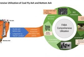
Research on "Utilization of Fly Ash and Bottom Ash at UPTE, PT. Bukit Asam "includes the mapping and characterization of coal in the PTBA working area, characterization of existing fly ash and bottom ash (FABA) from PLTU PTBA as raw material of cenosphere and Rare Earth Element (REE) as well as the manufacture of geopolymer concrete. In addition, there is also a study of ashing against coal that has the potential to contain high REE and characterization and its REE.

Figure 1. Documentation for sampling research in PT coal field. Bukit Asam


You can access the publication related to the above research theme at the link below:

[1] Hirajima, Tsuyoshi, et al., 2010, Recovery of Cenospheres from Coal Fly Ash Using a Dry Separation Process: Separation Estimation and Potential Application, International Journal of Mineral Processing, vol. 95, No. 1-4, pp. 18 – 24., doi: 10.1016/J. Minpro. 2010.03.004.

[2] Peter, H.T.B.M., et al., 2011, Performance of Dry-Separation Processes in the Recovery of Cenospheres from Fly Ash and Their Implementation in a Recovery Unit, International Journal of Mineral Processing, vol. 98, No. 1-2, pp. 15 – 23., doi: 10.1016/J. Minpro. 2010.09.002.

[3] Anggara, F., et al., 2018, Rare Earth Element and Yttrium Content of Coal in the Banko Coalfield, South Sumatra Basin, Indonesia: Contributions's from Tonstein Layers, International Journal of Coal Geology, vol. 196, pp. 159 – 172., doi: 10.1016/J. Coal. 2018.07.006.

[4] Anggara, F., et al., 2019, characteristics and Genesa enrichment of soil elements sparsely on coal field of estuary of Big Three northern coal, Cape Enim, South Sumatera Basin, Geology Resource Bulletin, vol. 14, No. 3, pp. 198-212.

[5] Fatikhin, Rais, et al., 2019, Synthesis of Dry-Mix of Fly Ash Based Geopolymer, doi: 10.1063/1.5095028.

[6] Adelizar, A S, et al., 2020, Fly Ash and Bottom Ash Utilization as Geopolymer: Correlation on Compressive Strength and Degree of Polymerization Observed Using FTIR, IOP Conference Series: Materials Science and Engineering, vol. 742, pp. 012042., doi: 10.1088/1757-899x/742/1/012042.

High-ranking coal mineralogical change to grafitization on Laya water Mining coal, South Sumatera

Research Topics Monday, 6 April 2020

Year of research: 2019

Source of funds: Department of Geological Engineering UGM

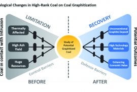
Research on "The change of high-ranking coal mineralogical to the grafitisation in Laya Water mining, South Sumatera" aims to determine the potential utilization of coal in contact with intrusion. The results of this research are expected to be used as a basis in determining residual coal development as a result of frozen rock intrusion.

Figure 1. Coal-like intrusion affected by grafitization

You can access the publication related to the above research theme at the link below:

[1] Tambaria, T.N., Amijaya, H. and Anggara, F., 2017, Intrusion Effect to Rare Earth Element Enrichment on Coal in Air Laya Area, South Sumatera, International Symposium on Earth Science and Technology.

[2] Maulana, A., Patria, A.A. and Anggara, F., 2019, effect of intrusion on graphite content in coal water mining Laya Mining Area PTBA Tanjung Enim, South Sumatra, Department of Geological Engineering.

Cleat system studies and relation to low-ranking coal permeability

Research Topics Sunday, 5 April 2020


Year of research: 2016

Source of funds: Department of Geological Engineering UGM

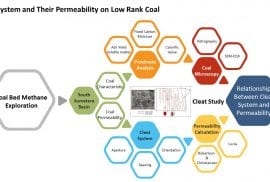
Permeability is one of the most important factors in the exploration of the CBM. Research on "Cleats system studies and its associated with low-ranking coal permeability" aims to determine the influence of cleats systems on low-ranking coal permeability.

Figure 1. Petrology Cleats (1a) pyrite, (1b) incision, pyrite, (2a) amber, (2b) incision, amber-polishing ppl, (3a) silica, (3b), silica polishing incisions.

You can access the publication related to the above research theme at the link below:

[1] Maulana, T. and Anggara, F., 2016, Relation Cleat system with the permeability of low-ranking coal, at West Banko mine, Muara Enim, South Sumatera, Proceeding National Seminar of the 9th Kebumian role Research of earth science in Community Empowerment, pp. 227-240

12

Recent Posts

  • Published Article: Petrological, Mineralogical, and Geochemical Compositions of Coal in the Ombilin Basin, West Sumatra, Indonesia
    March 7, 2023
  • 3 UGM Students Secured 1st Place in Poster Competition “Young Scientists’ Symposium Visions for The Future of Geoscience”
    April 1, 2022
  • New Paper: Evaluation of peat character in Kutai lakes area, Kalimantan Timur, Indonesia
    August 16, 2021
  • SGLC-ERIC Activities
    December 17, 2020
  • SGLC – ERIC Faculty of Engineering UGM
    December 17, 2020
Universitas Gadjah Mada

Universitas Gadjah Mada
Faculty of Engineering

© Unconventional Geo-resources Research Group, Universitas Gadjah Mada

KEBIJAKAN PRIVASI/PRIVACY POLICY